
[UPDATE, MARCH 15, 2019: The Conservation, Management, and Recreation Act was signed into law this week. Part of the law authorizes the placement of American Discovery Trail signs on federal lands. Also, H.R. 726, which would “amend the National Trails System Act to include national discovery trails and to designate the American Discovery Trail,” has been introduced in the House of Representatives. Bob Palin, of the American Discovery Trail Society, says the House bill “is currently gathering co-sponsors.”]
Imagine loading your backpack for a long hike, heading to the B-Line Trail, and, without ever leaving an official hiking path, hoofing it to the Pacific Ocean.
Or to the Atlantic.
On foot.
It could happen.
For years, officials in both Bloomington and Monroe County governments have discussed developing some kind of nonmotorized trail from Bloomington to Yellowwood State Forest, about ten miles east of town. From there, groups such as the Knobstone Hiking Trail Association and the Hoosier Hikers Council have worked on trails that will eventually connect Yellowwood to the Knobstone Trail in Jackson County.
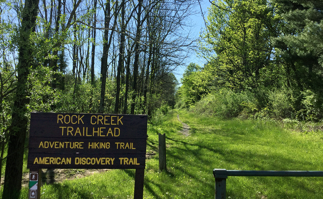
From there, take the Knobstone about 60 backwoods miles south where, about 20 miles north of Louisville, the trail joins the American Discovery Trail (ADT) — a 6,800-mile, coast-to-coast phenomenon that is the first of its kind in the country.
Imagine exploring Devonian-age fossil beds, a preserved Native American village, and the forests of John Audubon’s bird studies — and in between finding Abe Lincoln’s boyhood home, the world’s second-largest clock, and North America’s largest inland boat builder. All in Indiana, and all along the ADT.
The American Discovery Trail, which continues to be a work in progress, began in 1989 when Backpacker magazine and the nonprofit American Discovery Trail Society conceived of a nonmotorized, transcontinental trail. The original route traveled through a dozen states from Delaware to California, including a few hundred miles along the sole of boot-shaped Indiana.

The ADT remains a work in progress. | Image by American Discovery Trail Society, discoverytrail.org.
In the 1990s, a northern loop through the Midwest was also mapped, so now the ADT splits just west of Cincinnati: The southern route goes through southern Indiana, Illinois, Missouri, Kansas, and eastern Colorado to Denver, while the northern route arcs through northern Indiana to the Chicago area and continues west across the prairie states. In Denver, the northern and southern routes rejoin, and the ADT crosses the Rockies to the desert in Nevada and finally ends at the Pacific Ocean north of San Francisco.
When the American Discovery Trail was first developed, 65 percent of it was on city streets, rural roads, and even state highways. Since then, local volunteers have moved thousands of miles of the route to greenways and other nonmotorized trails. According to the ADT’s official website, today only about a third of the trail remains on roads — “both paved and unpaved.”
Because the ADT is the first coast-to-coast trail, because it connects natural areas to urban ones, and because it links other national trails (the Appalachian, Pacific Crest, and Santa Fe trails, to name just a few), its supporters call it “the backbone of the nation’s trail system.” They’ve been trying almost since its inception to have Congress enact the National Discovery Trails Act to make it an official national trail. Until then, it’s development remains sketchy at best.
Not only is the ADT unique, it’s also the most accessible trail in the country. With 36 million Americans living in its corridor, a hike along any part of it — even from, say, Fredonia to Artists Point in southern Indiana — is a hike of national scope.
When I first heard about the ADT in the late ’90s, I wondered how Indiana’s section would stack up to those in other states. Having hiked in some of the most remarkable places on the planet — such as New Zealand’s Southern Alps, Sumatra’s volcanic mountain ranges, and the trekker’s paradise of Nepal — I wanted to see what my home state offered beyond strip malls in the suburbs and strip mines in the scrubs. I had to see for myself.

New Albany is one of the many small southern-Indiana towns the ADT passes through. | Photo by Ron Eid
‘You know, you can get there by car.’
Indiana and Illinois are the only two states with both northern and southern ADT routes spanning their borders. My hiking partner, Mike, and I chose to hike Indiana’s southern route because it was older and, we presumed, more established (read: better marked; reread: presumed).
Westbound from Lawrenceburg, we followed the ADT through hollows and vales from one Hoosier town to the next, places called Hamburg, Canaan, French, Vienna, China, Friendship, and Sassafras.
Sometimes when we asked for directions to places such as Chelsea and Lottick Corner, people would say they’d heard of them but couldn’t tell us how to get there. And there were towns like Buffalo, Terry, and Apalona that were on our map but no one living nearby had heard of them.
“I’ve lived all my life on Apalona Road,” said one middle-age store clerk, “but I never heard of a town called Apalona.”
The few people who had heard of the ADT seemed blasé about its possibilities. And who can blame them? After all, the Lincoln Heritage, George Rogers Clark, and Chief White Eyes trails — all of which are paved roads now — have been around for years, and, as a resident in Fulda put it, “They ain’t done much for us.”
When another was told a coast-to-coast trail might be passing nearby, he shrugged, eyed us suspiciously, and said, “A lot worse has come through here.”

Indiana hosts both a Northern and a Southern ADT Route. | Image by American Discovery Trail Society, discoverytrail.org.
Does Indiana even need a new trail?
Several Hoosiers along the route didn’t seem to understand our hiking venture.
“You mean you’re walking to Madison?” said one baffled resident. “You know, you can get there by car.”
He had a point. Most of the trail never strays far from paved roads, making many of its interesting sights accessible by car.
But a car wouldn’t have given us the thrill of hiking pine-needled paths, limestone canyons, tall-grass meadows, dazzling glens, and rare forests of poplar, sycamore, hickory, white oak, and black walnut. And the trail led us to caves, waterfalls, a Civil War battleground, and a monastery that hasn’t changed (in spirit, anyway) since the 15th century.
We found towns where 19th-century architecture meant both log cabins and Greek Revival. We came across such local lore as a provincial lottery game called “straws,” the best fried bologna sandwiches this side of Italy, and euchre tournaments and “shootin’ matches” all over the place.
One of the American Discovery Trail’s more alluring qualities is its appeal as an old-fashioned trail, the kind used for getting from Point A to Point B. Hiking the ADT is a throwback to the original purpose of hiking, in which you hit the trail not just for the adventure of the trip itself but for what curiosity, what new world, might lie at the end of it.
Not all of our encounters were pleasant. Some leery locals were as thorny and annoying as the briar patches in the woods. Arriving in one town at dusk without a campground, inn, or motel in sight, we found a vacant lot void of “No Trespassing” signs and set up camp. Just as we were drifting off, a policeman paid us a visit.
At least I assumed he was a policeman. The word “Police” was spelled out on his car door in white house paint, but the words on his T-shirt read, “That’s Mr. Asshole to You!”
Whatever his official capacity, he told us that we were in fact trespassing and demanded to see our identification. I thought better of trying to lighten the mood by asking, “How’s Mrs. Asshole this evening?”
It was a tense moment, until he asked what we were up to. I explained our mission and showed him a topographic map of the area, with the ADT running through it. He softened and became at once curious and proud that a national trail went through his town — so delighted that he spent the better part of an hour describing the tricky bend in this country road and the fork in that one. Finally, he said, “Oh, what the hell. There’s no harm in y’all staying here the night.”

From a vista along the ADT in Leavenworth, Indiana, a tugboat pushes a barge around a bend in the Ohio River. | Photo by Ron Eid
‘You’re not Spencer County boys, are you?’
Usually, towns were more hospitable and civilized than the wilderness. After days of a grueling hike through the nettled thickets of an alleged river trail, Mike and I walked out of the woods, muddy, bloody, and tired, to look for an antidote to the trail mix, powdered lasagna, and other hiker gruel that we’d been living on for days.
The remedy was at a restaurant in a secluded bottomland town: a fried-chicken dinner, served Amish style with homemade bread and apple butter. As we ate, a genial, talkative man at the end of the bar asked about our trip. He wore bib overalls and a trucker hat, was named Iggy, and offered suggestions about what to see in the area. He invited us to his lodge.
“They’re holding a shootin’ match tonight,” Iggy said, as if that were all the persuasion we needed.
I wondered what a southern-Indiana shootin’ match entailed. A series of backwoods duels? The last man standing wins?
“Can we just watch?” I asked.
“Did you bring your guns?” Iggy asked.
“No.”
“Then you better just watch,” he said.
The lodge resembled a rustic roadhouse on the outside. As soon as we entered, Iggy slipped away, leaving us to fend for ourselves. The crowd inside seemed like any gathering of rural and small-town residents, dressed in various combinations of Western or flannel shirts, pressed or worn jeans (mostly worn, but generally in better condition than mine), and assorted boots or sneakers. Before long, a woman in mom jeans and an Orlando Magic sweatshirt marched up to us.
“You’re not Spencer County boys, are you?” she said.
“No.”
“Where you from?”
“Up north.”
“What are you doing here?” she said, squinting a little.
We told her we’d been hiking in the national forest.
“I knew it,” she said, laughing and slapping her knee, as if she’d just won a bet. “Some of the guys think you’re Excise.” She motioned vaguely toward the back of the room where a few men were pretending not to look at us.
“Who, us?” Mike said, laughing. We hardly looked like government agents — with Mike’s shoulder-length hair and Amish shave (long beard, no mustache) and my muddy clothes from trying to wade through a marsh earlier that day.
She nodded. “I told those guys, ‘They’re not Excise — look at their shoes’!” She reckoned that “G-men” would be wearing shiny black wingtips.
The rest of the night, she and the others made us feel welcome. The shootin’ match went off without a hitch: Behind the lodge, men, women, and children lined up ten at a time, like golfers at a driving range, and fired their shotguns at wooden targets 40 yards away. The shooter who put a lead pellet closest to an “X” cut into the board won that round. The grand prize was half a beef, with the runners-up winning beef shanks and pork sausages.
When the match was over, those of us left standing went inside. It was a big Saturday night in a small town. The adults drank, played pool, did excisable things, and, in Iggy’s case, danced a lively barnyard jig.

In the rolling hills of southern Indiana, the ADT passes St. Meinrad Archabbey, which was built between 1899 and 1907 with sandstone mined from a nearby quarry. | Photo by Ron Eid
A distinctly Hoosier walkabout
Leaving the hubbub of one town meant meandering the trails and backroads to another. We were pleased — you could say amazed — at what we found. Sometimes it was the little things, as on the country lane where we stopped at a fencerow to pet some horses. They looked at us mockingly, as if to say, “You know, you can get there by car.”
Or when the road rose from the Anderson River valley and crested a ridge, we saw a ray of sunlight slice through a breach in the overcast sky and glint off the distant stained-glass windows of a church. It reminded me of rounding a hilltop glade in Belgium and looking across the fields toward the medieval town of Bruges.

A patch displaying the original version of the ADT, with what is now the southern route.
We found Bruges’ not-so-distant cousin in the village of St. Meinrad. The Romanesque-style church at St. Meinrad Archabbey was built between 1899 and 1907 from sandstone quarried nearby. Despite our being dirty and ragged from the trail, the monk who greeted us offered the hospitality of his monastery: a low-priced meal and a room in the guesthouse; or, if we preferred, we could pitch our tents on their wooded grounds. We declined the lodging but ate, rested, and toured the monastery before moving on.
Although many of the accents and vestiges of the local culture in southern Indiana are derived partly from their French, Dutch, Swiss, German, Italian, Flemish, and Scotch Irish ancestry, giving our trip the semblance of a European hike, this was a uniquely American and a distinctly Hoosier walkabout: wandering country roads and small-town lanes, seeing satellite dishes next to barns with “Chew Mail Pouch” fading on the side, or visiting a corner grocery with worn wooden floors and a table and chairs in the middle, where the store owner and idle friends ate pickled eggs and discussed the hometown basketball team.
As our hike was in November, we witnessed Indiana’s version of Friday Night Lights. From a distance, we’d see the glow of stadium lights where high school football games were being played. We attended one and had to ask which team was which because we couldn’t tell from the jerseys. They said that’s because the visiting team was wearing the home team’s junior-varsity jerseys, since they couldn’t afford their own.
Sometimes it seemed we were light years from civilization, as when we hiked the 28-mile Adventure Trail in Wyandotte Woods, with its ferny undergrowth and conveniently spaced shelters. We had our share of misadventures, too, spending hours on ancient bison trails hunting for ADT trail markers. Or finding a holler where some dumbass had dumped his old tires and broken fridge in the otherwise pristine forest.
We watched sternwheelers and tugboats plying the Ohio River at sunset, enjoyed the geniality of a roadside inn and its owners, and met a red-headed storekeeper who claimed to be a descendant of Tecumseh. At a bar, we saw a band with a drummer who played standing up, keeping time on a washboard, cowbell, and snare drum. One of the regulars in the crowd, a punch-drunk ex-Marine, called the drummer “Percussion on a Stick,” and kept reminding us, “He’s a Floyd County boy!”

Local supporters hope to connect the B-Line Trail to the Knobstone Trail (shown here), which joins the ADT at Deam Lake State Recreation Area. | Photo by Ron Eid
Coast to coast on foot
Last spring, I tried to retrace parts of the American Discovery Trail that we had taken between Clarksville and Corydon. It was impossible. I couldn’t find a trail marker for the ADT anywhere in the towns or country and saw it marked on only one trailhead in a state forest.
And it’s Indiana’s loss. A national trail like the ADT could attract hikers by the thousands, especially to southern Indiana, where trekkers could experience pastoral landscapes, lush forests, and one iconic Hoosier town after another.
Almost every year since the 1990s, the ADT Society has found sponsors on both sides of the aisle in the U.S. House and Senate to introduce legislation that would designate the ADT as the first National Discovery Trail. The legislation has yet to pass and usually doesn’t even make it out of committee hearings. Even though sponsors say it would require no taxpayer money to enact (that’s zero dollars), opponents often cite cost as a factor.
If Congress does make it official, the ADT could evolve from a hard-to-find trace into a backpacking destination. And you may be able to get there on foot from Bloomington, if efforts by local officials succeed.
A trail connecting Yellowwood to the Knobstone is on the Indiana Department of Natural Resources’s list of “Priority Visionary Trails” published in its 2006 Indiana State Trails, Greenways and Bikeways Plan. And a progress report published last year shows such a “potential” trail connecting Bloomington to the Knobstone.
Steve Morris, director of the Indiana DNR, says that while the DNR doesn’t actively pursue trail building, his department supports groups like the Hoosier Hikers Council that want to do the work, from getting land easements to blazing trails.
So imagine lacing up your boots, heading to the B-Line, and ending up at the ADT. At that point, you’ll have to make a decision: east to Delaware or west to California.
Update January 29, 2016:
Suzanne Mittenthal, board member of the Knobstone Hiking Trail Association, sent us the following suggestion on connecting Bloomington to the Knobstone Trail.
“As founder and longtime director of the Hoosier Hikers Council (designer and builder of the Tecumseh Trail, among others), and founder (2013) and now a Board Member of the Knobstone Hiking Trail Association, the 150-mile linear trail on the Knobstone Escarpment, I’d be glad to advise on a way to connect the Knobstone eastward.
My guess is it would have to swing:
(1) southeast down to the public lands near Paynetown and the Monroe Reservoir lands along SR 446. Cross on the causeway there, then trek southeast toward trails along Tower Ridge Road and over to Houston, to connect up to the Knobstone Hiking Trail/Hoosier National Forest “Nebo Ridge Trail” there; or
(2) eastward through the forested lands north of SR 46 to connect to Yellowwood State Forest.
I think a trail connection east to Yellowwood State Forest would be grand for Bloomington.
Suzanne Mittenthal
Knobstone Hiking Trail Association”